Fox’s Point Scenic Railway.
There is always something new to discover up in the Dandenong Ranges,
and when I say new, of course I mean old. For a while now on local history
pages, I’ve seen promotional postcards and advertising of a scenic railway at a
place known as Fox’s Point. The railway was privately owned and was on the Mt.
Dandenong Tourist Road at the edge of Kalorama and ran 200 feet (61 metres) up the
Northern side of the mountain to a lookout platform that gave amazing views, and
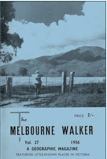
had a kiosk and museum. According to an article in Melbourne Walker Magazine
in 1956, it states that through an astronomical telescope at the lookout, it
enabled you: “…to see planes at
Essendon airport…and…to tell time by the Lilydale clock five miles away”.
 |
| 1961 Melbourne Walker |
But as usual,
I had to check it out for myself. There just may be some evidence left.
For a change,
the original site was easy to find. Records show it was a mile (1.6 Km) past
the Montrose township and was accessible on the Croydon to Mt. Dandenong bus.
This was convenient as the bus stop and the bus route still exist today. In one
of the early photos, the siding for the bus stop is visible. To make things
even easier, when the road was realigned curbing was built and a
driveway/crossover was conveniently placed where the railways entrance was.
Now, this sounds all well and good for finding the site, but much
has happened to that side of the road since then. Besides the entire railway
being removed in 1965, bushfires also hit the area again in 1972,73,74,83 and
1997. In addition, during the early
1970s landslides occurred, with the main road becoming blocked. Though repairs
were made by the Government, further slippages required major restoration of
the road, and additional drainage was built into the hillside to avoid slips reoccurring
in the future.
 |
| The site now |
 |
| The site 1960 |
It was believed that these
landslides were the result of the land being cleared for the railway
infrastructure and previous bushfires.
To complete the picture, the
area from the road up to where the platform had been, was purchased and
integrated as part of the Dandenong Ranges National Park in 1987.
After all that, I really
wasn’t expecting to find a lot, but I am an optimist.
As usual, I
brought my trusty assistant, Madelyn, because on a site as steep as this with
questionable stability and hugging the side of the highway (not to mention it
rained the night before) , my ambitions and ability are totally mismatched. I
need Madelyn to remind me of this before I create a new gymnastic routine
whilst stumbling down the mountain and breaking countless bones. And all this
before I get hit by a passing car.
Arriving at my destination, I
was excited to see that where the crossover was, there seemed to be a track
leading up the hill. It quickly became apparent that this was from earlier
excavating work from years earlier. Whether it was for a fire track or
temporary parking for trucks during old works was unclear as it was covered in
thick bush and quickly became part of the steep incline. As I looked back
towards the road, I also could see it didn’t align with the road as earlier
pictures indicated. The whole face of the hill had changed dramatically.
Knowing that the rails and infrastructure were long gone and that the area
where the platform once was, wasn’t accessible, I concentrated on the lower
level where the ride entrance used to be.
Rummaging down near the road and a few metres up the hill and to the side I started to notice that some of the rocks were of a different colour and more square in appearance. It was then I realised it was weathered and dirty concrete. Either from the stairs from the base ride entrance or the platform above. With the landslides and excavation work, it was impossible to tell. But it was an artifact from the original scenic railway.
It was satisfying that the
mountain still was willing to give up some of its past for today.
References:
I
can’t recommend highly enough the website https://bpadula.tripod.com/foxpoint/ which was an invaluable resource in this adventure.


